ESA TPM Map Catalogue - Product List
back to previous node |
list of download URLs

Collection G2_Portugal_2021
GEOSAT-2 Portugal Coverage 2021 collection. More details here.
List of available products (latitude from 37.0188 to 37.0972 dg, longitude from -8.045 to -7.90062 dg)..
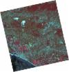
DE2_OPER_HRA_PSH_1C_20210708T110752_N37-113_W008-068_0001
Download Product | Product Info | Browse
Platform Short Name | GEOSAT |
Platform Serial Identifier | 2 |
Product Type | HRA_PSH_1C |
Start Date | 2021-07-08T11:07:52Z |
Stop Date | 2021-07-08T11:07:55Z |
Original Name | DE2_PSH_L1C_000000_20210708T110752_20210708T110755_DE2_38217_820F.zip |
Footprint | 37.0619385074 -7.97916198553 37.1885665009 -8.01256869705 37.1644724082 -8.1588662215 37.0378819141 -8.12520809681 37.0619385074 -7.97916198553 |
Orbit Direction | ASCENDING |
Scene Centre Longitude | W008 |
Scene Centre Latitude | N37 |
Cloud Cover Percentage | -1 |
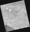
DE2_OPER_HRA_PM4_1C_20210708T110752_N37-113_W008-068_0001
Download Product | Product Info | Browse
Platform Short Name | GEOSAT |
Platform Serial Identifier | 2 |
Product Type | HRA_PM4_1C |
Start Date | 2021-07-08T11:07:52Z |
Stop Date | 2021-07-08T11:07:55Z |
Original Name | DE2_PM4_L1C_000000_20210708T110752_20210708T110755_DE2_38217_820F.zip |
Footprint | 37.0619385074 -7.97916198553 37.1885665009 -8.01256869705 37.1644724082 -8.1588662215 37.0378819141 -8.12520809681 37.0619385074 -7.97916198553 |
Orbit Direction | ASCENDING |
Scene Centre Longitude | W008 |
Scene Centre Latitude | N37 |
Cloud Cover Percentage | -1 |
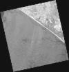
DE2_OPER_HRA_PSH_1C_20210708T110750_N36-998_W008-038_0001
Download Product | Product Info | Browse
Platform Short Name | GEOSAT |
Platform Serial Identifier | 2 |
Product Type | HRA_PSH_1C |
Start Date | 2021-07-08T11:07:50Z |
Stop Date | 2021-07-08T11:07:53Z |
Original Name | DE2_PSH_L1C_000000_20210708T110750_20210708T110753_DE2_38217_0E34.zip |
Footprint | 36.9468634703 -7.94922291516 37.0736879056 -7.9822780566 37.0495669097 -8.12833812754 36.9228334529 -8.09504021573 36.9468634703 -7.94922291516 |
Orbit Direction | ASCENDING |
Scene Centre Longitude | W008 |
Scene Centre Latitude | N36 |
Cloud Cover Percentage | -1 |
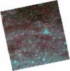
DE2_OPER_HRA_PM4_1C_20210708T110750_N36-998_W008-038_0001
Download Product | Product Info | Browse
Platform Short Name | GEOSAT |
Platform Serial Identifier | 2 |
Product Type | HRA_PM4_1C |
Start Date | 2021-07-08T11:07:50Z |
Stop Date | 2021-07-08T11:07:53Z |
Original Name | DE2_PM4_L1C_000000_20210708T110750_20210708T110753_DE2_38217_0E34.zip |
Footprint | 36.9468634703 -7.94922291516 37.0736879056 -7.9822780566 37.0495669097 -8.12833812754 36.9228334529 -8.09504021573 36.9468634703 -7.94922291516 |
Orbit Direction | ASCENDING |
Scene Centre Longitude | W008 |
Scene Centre Latitude | N36 |
Cloud Cover Percentage | -1 |
DE2_OPER_HRA_PSH_1C_20210331T111455_N37-147_W007-919_0001
Download Product | Product Info | Browse
Platform Short Name | GEOSAT |
Platform Serial Identifier | 2 |
Product Type | HRA_PSH_1C |
Start Date | 2021-03-31T11:14:55Z |
Stop Date | 2021-03-31T11:14:58Z |
Original Name | DE2_PSH_L1C_000000_20210331T111455_20210331T111458_DE2_36748_7B9E.zip |
Footprint | 37.0926622042 -7.82212107387 37.2260395941 -7.85566571205 37.201541167 -8.01763947045 37.068134422 -7.98427576803 37.0926622042 -7.82212107387 |
Orbit Direction | ASCENDING |
Scene Centre Longitude | W007 |
Scene Centre Latitude | N37 |
Cloud Cover Percentage | -1 |
DE2_OPER_HRA_PM4_1C_20210331T111455_N37-147_W007-919_0001
Download Product | Product Info | Browse
Platform Short Name | GEOSAT |
Platform Serial Identifier | 2 |
Product Type | HRA_PM4_1C |
Start Date | 2021-03-31T11:14:55Z |
Stop Date | 2021-03-31T11:14:58Z |
Original Name | DE2_PM4_L1C_000000_20210331T111455_20210331T111458_DE2_36748_7B9E.zip |
Footprint | 37.0926622042 -7.82212107387 37.2260395941 -7.85566571205 37.201541167 -8.01763947045 37.068134422 -7.98427576803 37.0926622042 -7.82212107387 |
Orbit Direction | ASCENDING |
Scene Centre Longitude | W007 |
Scene Centre Latitude | N37 |
Cloud Cover Percentage | -1 |
DE2_OPER_HRA_PSH_1C_20210331T111453_N37-026_W007-889_0001
Download Product | Product Info | Browse
Platform Short Name | GEOSAT |
Platform Serial Identifier | 2 |
Product Type | HRA_PSH_1C |
Start Date | 2021-03-31T11:14:53Z |
Stop Date | 2021-03-31T11:14:56Z |
Original Name | DE2_PSH_L1C_000000_20210331T111453_20210331T111456_DE2_36748_3BE8.zip |
Footprint | 36.971800501 -7.79190162718 37.1049168161 -7.8260248939 37.0804986755 -7.98736780701 36.9472397501 -7.95432209785 36.971800501 -7.79190162718 |
Orbit Direction | ASCENDING |
Scene Centre Longitude | W007 |
Scene Centre Latitude | N37 |
Cloud Cover Percentage | -1 |
DE2_OPER_HRA_PM4_1C_20210331T111453_N37-026_W007-889_0001
Download Product | Product Info | Browse
Platform Short Name | GEOSAT |
Platform Serial Identifier | 2 |
Product Type | HRA_PM4_1C |
Start Date | 2021-03-31T11:14:53Z |
Stop Date | 2021-03-31T11:14:56Z |
Original Name | DE2_PM4_L1C_000000_20210331T111453_20210331T111456_DE2_36748_3BE8.zip |
Footprint | 36.971800501 -7.79190162718 37.1049168161 -7.8260248939 37.0804986755 -7.98736780701 36.9472397501 -7.95432209785 36.971800501 -7.79190162718 |
Orbit Direction | ASCENDING |
Scene Centre Longitude | W007 |
Scene Centre Latitude | N37 |
Cloud Cover Percentage | -1 |
DE2_OPER_HRA_PSH_1C_20210319T112115_N37-032_W008-122_0001
Download Product | Product Info | Browse
Platform Short Name | GEOSAT |
Platform Serial Identifier | 2 |
Product Type | HRA_PSH_1C |
Start Date | 2021-03-19T11:21:15Z |
Stop Date | 2021-03-19T11:21:17Z |
Original Name | DE2_PSH_L1C_000000_20210319T112115_20210319T112117_DE2_36570_9E88.zip |
Footprint | 36.9729825056 -8.0101453425 37.1172282056 -8.04355751349 37.0915076695 -8.23489132706 36.9468749396 -8.20164523812 36.9729825056 -8.0101453425 |
Orbit Direction | ASCENDING |
Scene Centre Longitude | W008 |
Scene Centre Latitude | N37 |
Cloud Cover Percentage | -1 |
DE2_OPER_HRA_PM4_1C_20210319T112115_N37-032_W008-122_0001
Download Product | Product Info | Browse
Platform Short Name | GEOSAT |
Platform Serial Identifier | 2 |
Product Type | HRA_PM4_1C |
Start Date | 2021-03-19T11:21:15Z |
Stop Date | 2021-03-19T11:21:17Z |
Original Name | DE2_PM4_L1C_000000_20210319T112115_20210319T112117_DE2_36570_9E88.zip |
Footprint | 36.9729825056 -8.0101453425 37.1172282056 -8.04355751349 37.0915076695 -8.23489132706 36.9468749396 -8.20164523812 36.9729825056 -8.0101453425 |
Orbit Direction | ASCENDING |
Scene Centre Longitude | W008 |
Scene Centre Latitude | N37 |
Cloud Cover Percentage | -1 |