Static Map Catalogue - Full Metadata Record
Collection Cartosat
European Cities: Cartosat-1 Euro-Maps 3D. More details here.
CA1_OPER_DSM_DEM_3D_20090608T093104_N41-000_E019-000_4D
Download Product | Browse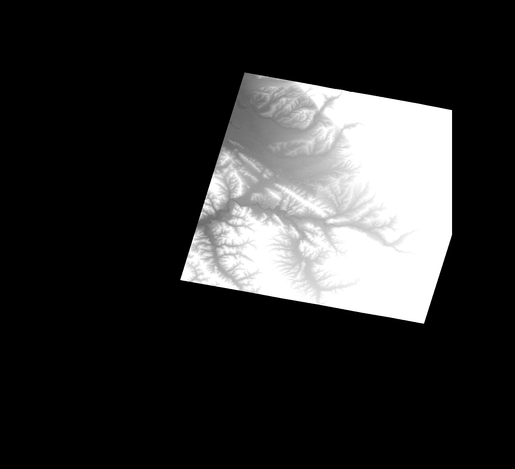
Start Date | 2009-06-08T09:31:04Z |
Stop Date | 2009-06-08T09:31:04Z |
Availability Time | 2009-06-08T09:31:04Z |
Platform Short Name | Cartosat |
Serial Identifier | 1 |
Instrument Short Name | DSM |
Operational Mode | DEFAULT |
Resolution | |
Orbit Number | 0 |
Orbit Direction | |
Path | |
Row | |
Illumination Azimuth Angle | |
Illumination Elevation Angle | |
Footprint | 41.4377092355 19.8523008569 41.434028495 19.8719977929 41.4104518595 20.0024651237 41.4104021198 20.0029127814 41.3360412125 20.0033106993 41.3359914728 20.0032609595 41.2500412068 20.003360439 41.1352916329 19.9672493898 41.1351424137 19.96719965 41.1910001386 19.653690086 41.1910498784 19.6534413873 41.1910996181 19.6530932091 41.1911493579 19.6528942502 41.1911990976 19.6527450309 41.4581522676 19.7353627346 41.458251747 19.7354124743 41.4585501855 19.735462214 41.4587988841 19.7355616935 41.4377092355 19.8523008569 |
Scene Centre | |
Size | 89828981 |
Id | CA1_OPER_DSM_DEM_3D_20090608T093104_N41-000_E019-000_4D |
Acquisition Type | NOMINAL |
Product Type | DSM_DEM_3D |
Status | ARCHIVED |
Bounding Box | 41.5524091 19.4201620 40.9473252 19.4201620 40.9473252 20.0844860 41.5524091 20.0844860 41.5524091 19.4201620 |
Site | Tirana |