Static Map Catalogue - Full Metadata Record
Collection Cartosat
European Cities: Cartosat-1 Euro-Maps 3D. More details here.
CA1_OPER_DSM_DEM_3D_20120804T100623_N41-000_E012-000_4B
Download Product | Browse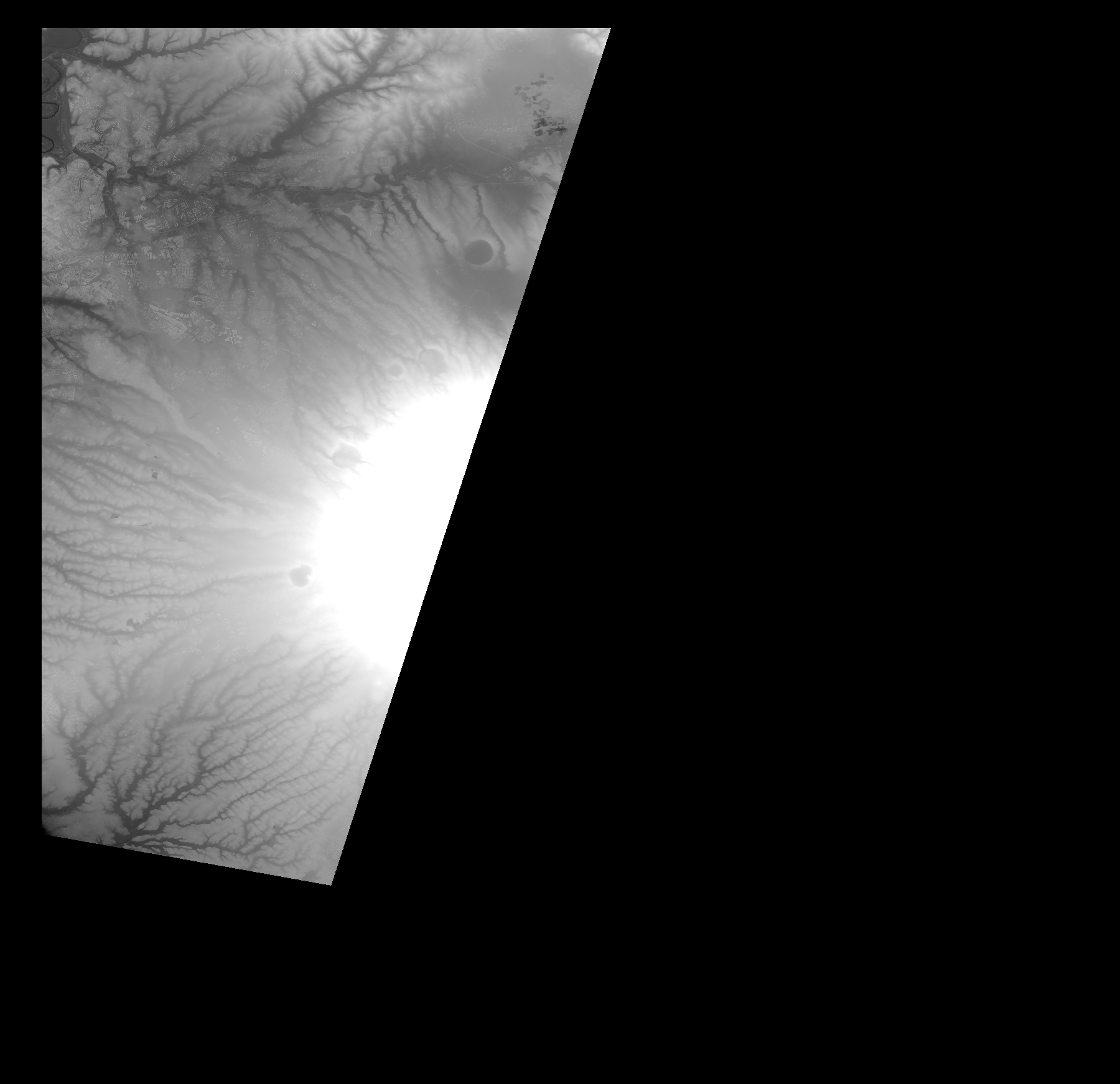
Start Date | 2012-08-04T10:06:23Z |
Stop Date | 2012-08-04T10:06:23Z |
Availability Time | 2012-08-04T10:06:23Z |
Platform Short Name | Cartosat |
Serial Identifier | 1 |
Instrument Short Name | DSM |
Operational Mode | DEFAULT |
Resolution | |
Orbit Number | 0 |
Orbit Direction | |
Path | |
Row | |
Illumination Azimuth Angle | |
Illumination Elevation Angle | |
Footprint | 42.0034055231 12.7745362776 42.0033548345 12.7758034939 42.0034055231 12.7761583145 41.9726375103 12.7672878001 41.9701030776 12.7664767816 41.9681769088 12.7658178291 41.9598132809 12.7630806418 41.9596105263 12.7630299532 41.9483069565 12.7593296814 41.9143455585 12.7481781776 41.9058298647 12.7453903017 41.891586353 12.7407269455 41.8568139365 12.7293219984 41.8448007256 12.7253682834 41.8364370977 12.7225804075 41.8215346336 12.7176129194 41.7958354861 12.7090972256 41.7834674546 12.7051941993 41.775509336 12.7025583893 41.7726200827 12.7015953048 41.7704404706 12.7008856637 41.7280647561 12.6870983499 41.6846245798 12.6731082814 41.668201456 12.6677859728 41.6533496805 12.6629705507 41.6516262662 12.6624129755 41.6456450051 12.6604868067 41.6239502613 12.6534410838 41.6068174963 12.6478653319 41.5812704149 12.6396030813 41.5810676602 12.6395523927 41.5808649056 12.639501704 41.6058037233 12.4976241622 41.6058544119 12.4973200303 41.6059557892 12.4967117665 42.0016821089 12.4966103892 42.0034055231 12.7745362776 |
Scene Centre | |
Size | 73223923 |
Id | CA1_OPER_DSM_DEM_3D_20120804T100623_N41-000_E012-000_4B |
Acquisition Type | NOMINAL |
Product Type | DSM_DEM_3D |
Status | ARCHIVED |
Bounding Box | 42.0172942 12.4760815 41.4827317 12.4760815 41.4827317 13.0282330 42.0172942 13.0282330 42.0172942 12.4760815 |
Site | Rome |