Static Map Catalogue - Full Metadata Record
Collection Cartosat
European Cities: Cartosat-1 Euro-Maps 3D. More details here.
CA1_OPER_DSM_DEM_3D_20120804T100623_N41-000_E012-000_4A
Download Product | Browse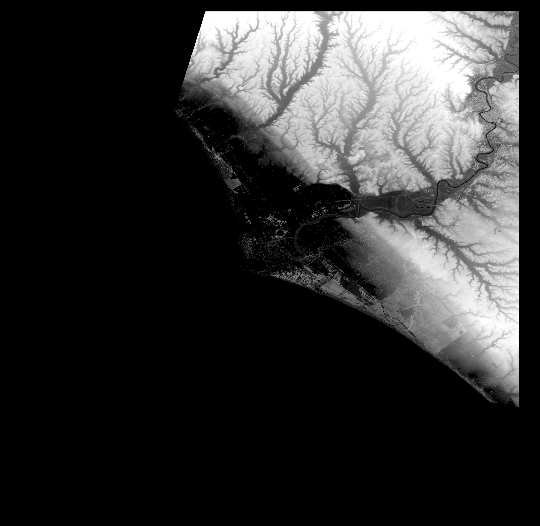
Start Date | 2012-08-04T10:06:23Z |
Stop Date | 2012-08-04T10:06:23Z |
Availability Time | 2012-08-04T10:06:23Z |
Platform Short Name | Cartosat |
Serial Identifier | 1 |
Instrument Short Name | DSM |
Operational Mode | DEFAULT |
Resolution | |
Orbit Number | 0 |
Orbit Direction | |
Path | |
Row | |
Illumination Azimuth Angle | |
Illumination Elevation Angle | |
Footprint | 42.0033704634 12.4998582127 42.0033704634 12.4998582127 42.0034212109 12.5013298909 41.6426063179 12.5032582968 41.6412361347 12.5033090443 41.63641512 12.3241195383 41.6364658675 12.3238150532 41.636516615 12.3235613156 41.6365673625 12.3232568304 41.6366688576 12.3231045879 41.6927448712 12.0901227068 41.6927956187 12.0898182217 41.6928463663 12.0895137365 41.6928971138 12.0892599989 41.7927174928 12.1205204735 41.8442262293 12.136759681 41.8739642781 12.1461479729 41.9043112973 12.1557392549 41.9159832277 12.1593930766 41.9377539154 12.1662947398 41.9506437864 12.1703545417 41.9913940478 12.1832951602 42.0014420575 12.1864922542 42.0027614931 12.1868982344 42.0029644832 12.1869489819 42.0031674733 12.1869997294 42.0033704634 12.4998582127 |
Scene Centre | |
Size | 44930109 |
Id | CA1_OPER_DSM_DEM_3D_20120804T100623_N41-000_E012-000_4A |
Acquisition Type | NOMINAL |
Product Type | DSM_DEM_3D |
Status | ARCHIVED |
Bounding Box | 42.0147887 11.9801528 41.4851875 11.9801528 41.4851875 12.5240648 42.0147887 12.5240648 42.0147887 11.9801528 |
Site | Rome |