Static Map Catalogue - Full Metadata Record
Collection Cartosat
European Cities: Cartosat-1 Euro-Maps 3D. More details here.
CA1_OPER_DSM_DEM_3D_20140313T085955_N46-000_E030-000_4D
Download Product | Browse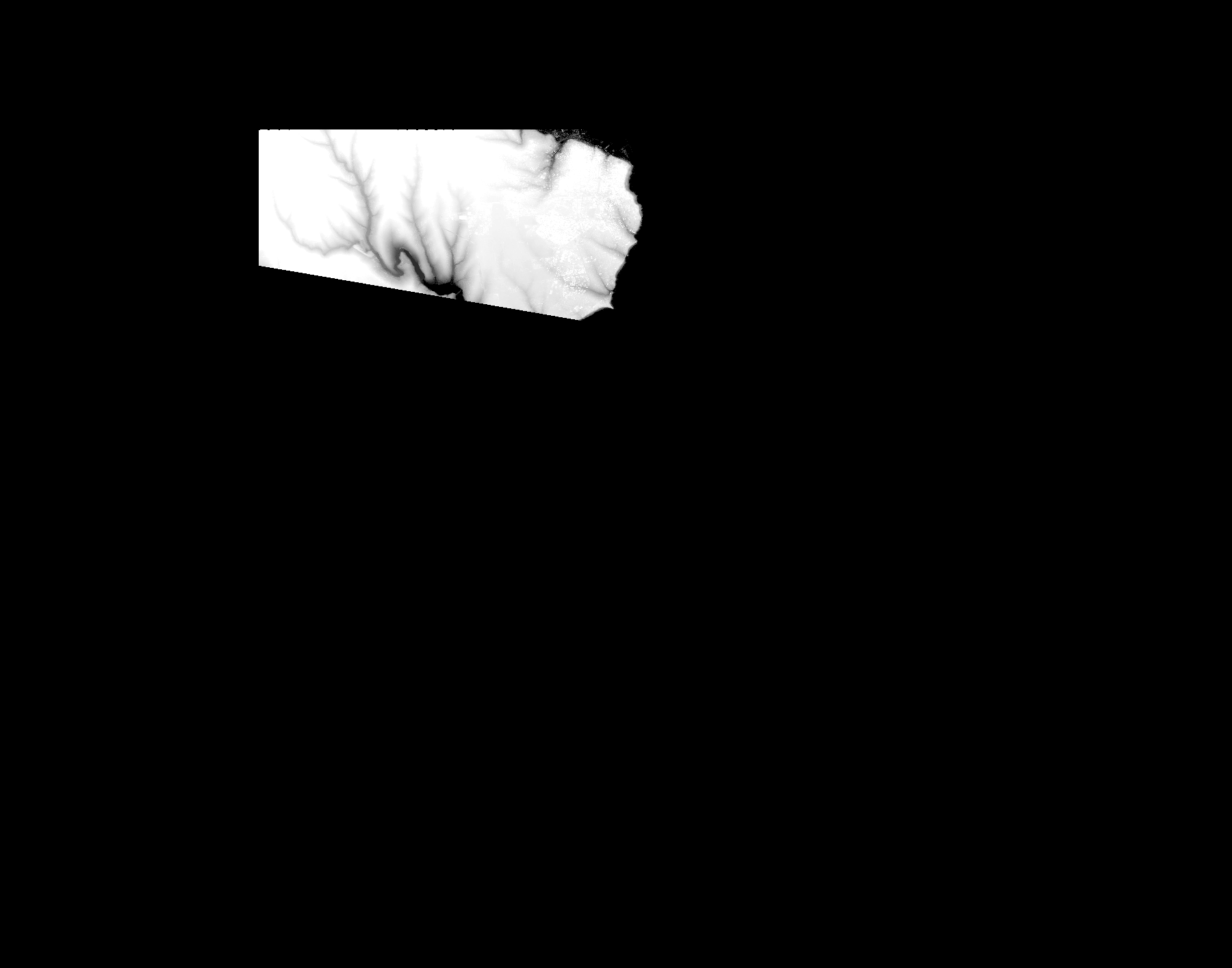
Start Date | 2014-03-13T08:59:55Z |
Stop Date | 2014-03-13T08:59:55Z |
Availability Time | 2014-03-13T08:59:55Z |
Platform Short Name | Cartosat |
Serial Identifier | 1 |
Instrument Short Name | DSM |
Operational Mode | DEFAULT |
Resolution | |
Orbit Number | 0 |
Orbit Direction | |
Path | |
Row | |
Illumination Azimuth Angle | |
Illumination Elevation Angle | |
Footprint | 46.5033870518 30.8180438283 46.5034358105 30.818482657 46.5033870518 30.8185314157 46.5014854609 30.8183363808 46.4973897267 30.8168248598 46.493586545 30.8154108563 46.4874429436 30.8131191955 46.4835910031 30.8117051921 46.4774474018 30.8094135312 46.4735954613 30.8079995278 46.471401318 30.8071706292 46.4616008112 30.8035624824 46.4554572099 30.8012708216 46.4516052694 30.7998568181 46.449411126 30.7990279195 46.4395131017 30.795371014 46.4374164759 30.7945908741 46.4034803925 30.7820598778 46.3976293436 30.7799144932 46.3954352003 30.7790855946 46.3714946587 30.7702602626 46.3693980328 30.7694801228 46.363546984 30.7673347382 46.3614015994 30.7665058396 46.360523942 30.7662620459 46.3604264246 30.7662132871 46.406015847 30.4974063506 46.4060646057 30.4971625569 46.4061133644 30.4969187632 46.4991938001 30.496577452 46.4997301463 30.4966749695 46.5031432581 30.496577452 46.5033870518 30.8180438283 |
Scene Centre | |
Size | 14977041 |
Id | CA1_OPER_DSM_DEM_3D_20140313T085955_N46-000_E030-000_4D |
Acquisition Type | NOMINAL |
Product Type | DSM_DEM_3D |
Status | ARCHIVED |
Bounding Box | 46.5963212 30.3113430 45.9031670 30.3113430 45.9031670 31.1943150 46.5963212 31.1943150 46.5963212 30.3113430 |
Site | Odessa |