Static Map Catalogue - Full Metadata Record
Collection Cartosat
European Cities: Cartosat-1 Euro-Maps 3D. More details here.
CA1_OPER_DSM_DEM_3D_20080815T090906_N44-000_E026-000_4C
Download Product | Browse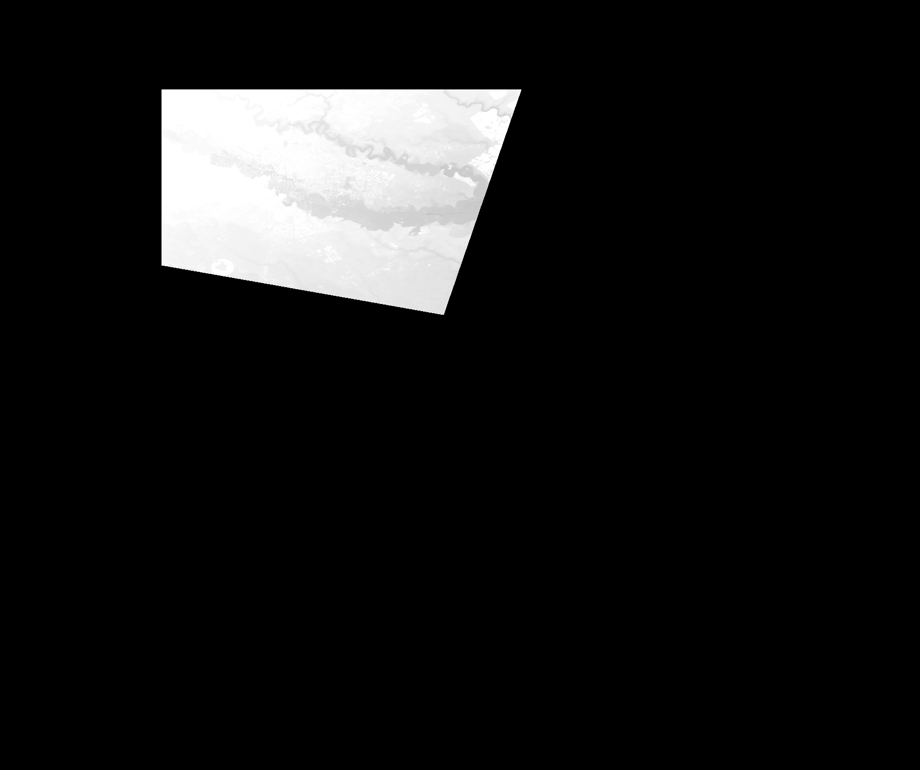
Start Date | 2008-08-15T09:09:06Z |
Stop Date | 2008-08-15T09:09:06Z |
Availability Time | 2008-08-15T09:09:06Z |
Platform Short Name | Cartosat |
Serial Identifier | 1 |
Instrument Short Name | DSM |
Operational Mode | DEFAULT |
Resolution | |
Orbit Number | 0 |
Orbit Direction | |
Path | |
Row | |
Illumination Azimuth Angle | |
Illumination Elevation Angle | |
Footprint | 44.5034496591 26.3048187037 44.5034003724 26.3049172772 44.5034496591 26.3051144241 44.5034003724 26.3052129975 44.3104921474 26.2388730714 44.3102950005 26.2388237847 44.3101471403 26.2387744979 44.3099992801 26.2387252112 44.3522872866 25.9975159998 44.3523365733 25.9972202795 44.35238586 25.9969245592 44.3530758741 25.9965795521 44.3548009093 25.9966288389 44.3707698068 25.9965795521 44.3776699477 25.9965795521 44.379394983 25.9966288389 44.3810214448 25.9965795521 44.38274648 25.9966288389 44.3899916279 25.9965795521 44.3933431249 25.9965795521 44.3966946219 25.9965795521 44.46480887 25.9965795521 44.468160367 25.9965795521 44.4698854023 25.9966288389 44.4736804798 25.9966288389 44.486692174 25.9965795521 44.4884172093 25.9966288389 44.4993588613 25.9966288389 44.4998024418 25.9966288389 44.5016753372 25.9965795521 44.502759645 25.9966781256 44.5029567919 25.9966288389 44.5030060786 25.9965795521 44.5034496591 26.3048187037 |
Scene Centre | |
Size | 46931775 |
Id | CA1_OPER_DSM_DEM_3D_20080815T090906_N44-000_E026-000_4C |
Acquisition Type | NOMINAL |
Product Type | DSM_DEM_3D |
Status | ARCHIVED |
Bounding Box | 44.5800905 25.8581332 43.9195006 25.8581332 43.9195006 26.6470657 44.5800905 26.6470657 44.5800905 25.8581332 |
Site | Bucharest |